
Seagrass Mapping & Monitoring
 20.09.2024
 5 minutes
The Environment and Resources Authority (ERA) has continued its work on the mapping of marine habitats. After detailed mapping of caves and reefs and sandbanks, including areas in Maltese deep waters, the ERA also continued its work on seagrass meadows.
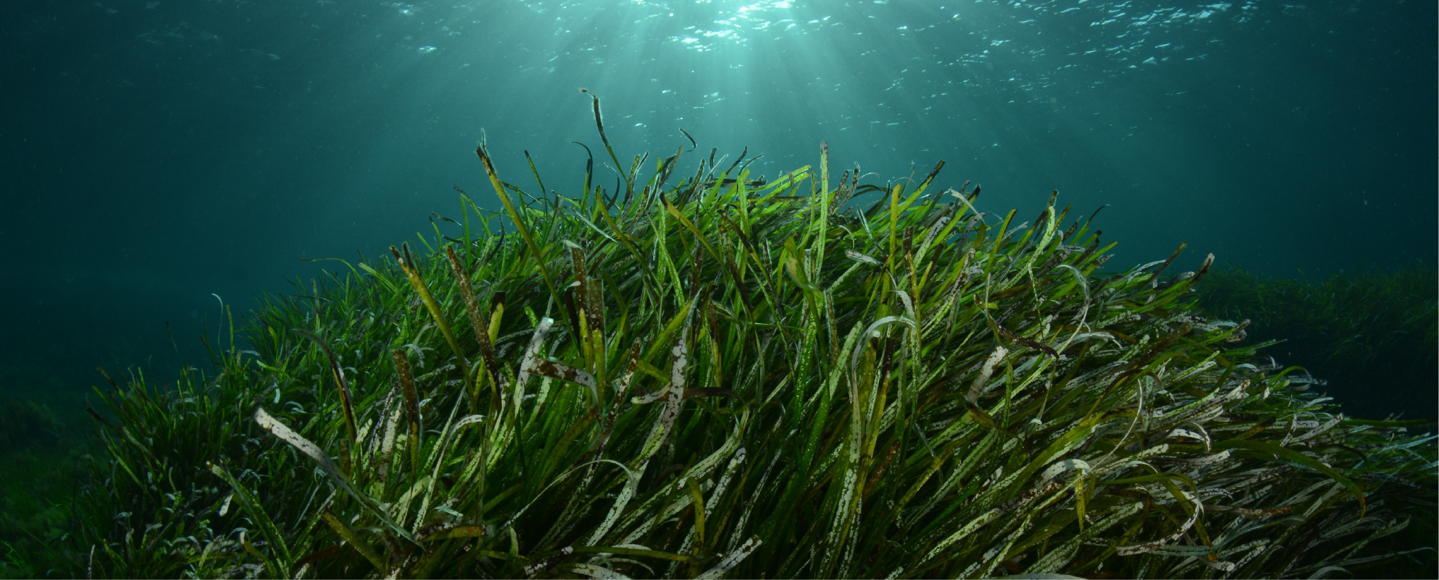
Seagrass meadows are one of the important marine habitats in the world. In the Mediterranean, Posidonia oceanicaseagrass meadows are considered of prime importance to safeguarding marine and coastal species, fish stocks and fisheries as well as coastal habitats – these being critical in controlling erosion and mitigating climate change.
ERA has been mapping Posidonia meadows as part of its National Marine Monitoring Programme, with the results being available under MEPS. These included traditional survey methods through transects and diving; however, ERA recently also participated in a project aimed at mapping and monitoring these seagrass meadows through more innovative means. The project, entitled ‘Mapping and monitoring of Posidonia oceanica using remote and sentinel technology’ (MAARES), was funded by the Malta Council for Science and Technology (MCST) Space Research Fund.
MAARES represents an innovative approach to the mapping and monitoring of Posidonia oceanica, a priority habitat at the European Union level under the Habitats Directive. By harnessing the power of Remote Sensing (RS) technology, the project aims to facilitate and improve the monitoring of this invaluable marine ecosystem, providing essential information for its effective management and conservation.
The overarching goal of MAARES was to generate high spatial resolution maps that offer insights into the ecology of seagrass meadows. Such a study served to enhance our knowledge of biodiversity and ecological services and also contributed to the future sustainability of these vital marine habitats across the Maltese Islands.
The Sentinel-2 image results were validated using underwater geo-referenced images and high-resolution, multispectral orthomosaics captured by Unmanned Aerial Vehicles (UAVs). This comprehensive work included the use of Artificial Intelligence (AI) and machine learning-based classification techniques to enable precision mapping of seagrass meadow extent.
By implementing such a monitoring program, ERA, as the responsible authority, is taking a proactive approach to better policy implementation and applied conservation initiatives to safeguard this priority habitat.
.png)
.png)


.png)